Saturday, July 14, 2007

The Mobile Geoblogger


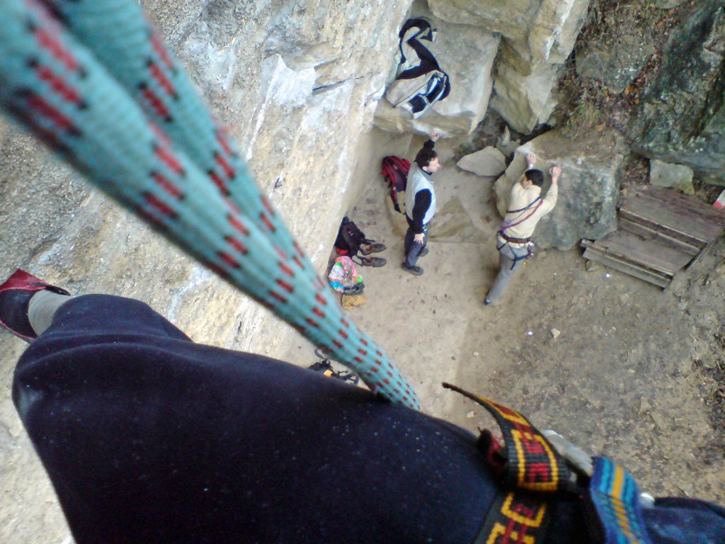
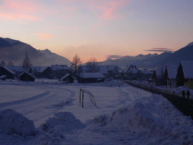
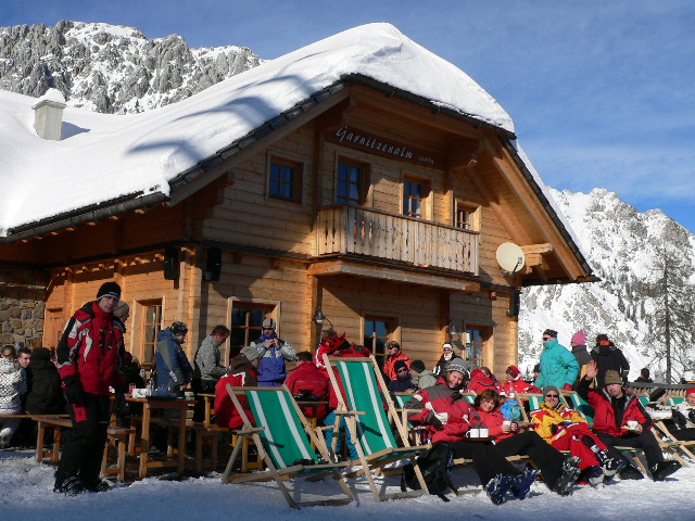
Every time when having fun somewhere far from home, I got the feeling that I should somehow tell the world what, where and how makes us feel so good. Just a few words like "Just reached the top, the panorama is incredible", or "Greetings from the Tour Eiffel, the sun is just setting over Paris", and maybe a photo for illustration.
Is it only my abberation?? Sure not...
Until now, I used to use my PDA to publish short articles on my blog - the one You are just reading. That was pretty good, apart from describing the location, which was not too smart. Could I embed my posts in a Google Map? From today, YES!
No special equipment or software is needed, just something that You can send an email with - either your cell phone or a PDA like I do. Some cool free webservices do the rest. Have a look at the posts of this blog, embedded in Google Maps: http://maps.google.com/maps?q=http://ws.geonames.org/rssToGeoRSS?feedUrl=http://adszhu.blogspot.com/feeds/posts/default

A brief summary how it operates:
You are at a fantastic place, and decide to let the visitors of your blog or homepage know where it is and how it looks. You take photo with your cellphone, and send it as an email to your blog account, describing the place where You took it. Your mail immediately appears in your blogspace as a new post. At the same time, the RSS feed of your blog gets automatically updated by the blog server.
A visitor happens to surf to your site, and finds a link like the one above. This link opens the well known Google Maps site, and tries to display the RSS of your blog, including the new post, too. But how does it get the coordinates to display on the map? There is a great, free webservice at geonames.org that reads RSS feeds, parse the location names in it and converts the RSS to GEORSS. Since the link refers to Your RSS not directly, but via this geonames service, it now has the necessary geospatial info to put it on a map. Naturally, mobile Google Maps clients are able to display Your blog post, too...

Thursday, June 28, 2007

Piz Bernina webcam and weather


The Alpine Weather and Webcam page has just been completed with Piz Bernina, the highest peak of the East Alps.

Don't miss to check it before leaving :)

Wednesday, June 27, 2007

A:L:P - the summit log update

The A:L:P summit log (the diary of our climbing and infobase of the mountains we have been to) has just gone through a general upgrade. From now, each place has a topographical map overlay, a GPS-tracklog, some POIs (mostly the peaks and the bivouac places), a photo gallery (except for the oldest ones) and hints in a few words.
Currently far the following peaks and routes are included:
  • Kreuzspitze, Saykogel, Similaun, Wildes Mannle, Wildspitze (Tirol, Austria)
  • Dufourspitze (Monte Rosa, Switzerland)
  • Mont Blanc, the 3-Mont-Blanc route
  • Piz Popena (Cristallo-group, Italy)
  • Dent du Géant (Mont Blanc)
  • Grossglockner, South normal route (Austria)
  • Schneeberg, Gamsgartlgrat route (Rax, Austria)

Check out the new layout and contents at My Places.

Pls. note that the cycling section has been temporarily removed; it is under construction, and going to get a separate room soon

Wednesday, June 20, 2007

Cycling routes near Budapest, Hungary


Looking for a cycling route near Budapest? Have a look at my favourites! Follow the link "Cycling" at My Places. All these itineraries refer to roads with fine surface, suitable for road race cyclists. The Isaszeg round is an easy one with moderate traffic. Dobogokő is the village that has the highest location in Hungary. The route there follows a public road with a long but not that steep elevation. The Pilis transverse is something extraordinary; it leads mostly on forest roads of very good quality but with low to zero traffic. It is easy to loose direction, don't forget your GPS...

Tuesday, May 29, 2007

Czech sights at My Places


Back from Czech Republic, I have posted our pics taken in Cesky Krumlov, Ceske Budejovice and Trebon. Each of these small towns are worth a couple of hours, and once You are there, do not skip a walk our cycle journey in the Sumava National Park.

On My Places, the "Czech Republic" link has been completed with the now visited cities, while the "Trekking paths" link contains a GPS-tracklog and a georeferred map tile of our walk in the Sumava forest

Friday, May 25, 2007

Jordan pics and map on My Places


Yes, we have been there, back in 2003. For Central European people like us (my wife and me), Middle East is a mysterious area, basically deviating from the places we are used to. Check out the map of Jordan, see our pictures taken there

Wednesday, May 23, 2007

Corsica link alive!


Exactly one month since the last post, I am glad to announce that the My Places portal is updated again! Having scanned some dozens of old slides, now the Corsica link is alive, showing map-based infobase and a photo gallery of our trip on this marvellous island. Give it a try now!

What's next? The A:L:P summit log is being reconstructed to give the reader even more useful info. Parallely, the file size is to be reduced so that browsing becomes faster. To be announced soon...

Tuesday, April 24, 2007

My Alps on Google Maps


Finally, Google Maps can find my shared contents, among others the ALP summit log! I have been waiting for the crawler of Google to index my kml files so that the info I have published is now available to anyone on the Internet! You can give it a try by querying for e.g. "Dent du Géant near Italy" - this is an incredible peak among Europe's 4000-ers, near Mont Blanc. Don't forget to chose "See results from the web" at the bottom of the search result tab - this is the gate to the user contents. My kml files with climbing info (including topos, track logs, detailed map overlays, recommendations, etc) are on the list, too!

For the uninitiated, You can create and publish your location-related stuff using the My Maps tab of Google Maps

Wednesday, April 11, 2007

Selected trekking routes @ My Places


There used to be a link at My Places to Trekking paths from the very beginning, however, the link has just been set to live. It is dedicated to recommend some great routes to those looking for fine one-day-long adventures. At the same time, the ALP summit log has been completed with the tracklog of the Gamsgartlgrat-climb

Google to become the Ultimate Mapping Service


Nowadays, the most of the navigating solutions operate on the client side, eg. on your PDA or GPS handlet. Typically, You buy the navigation software and a set of maps. Some of the biggest trades of this kind are Tom-Tom and via Michelin. Day by day, your "static" map expires, more and more details get obsolete. So You need to look for some map update, for which You likely have to pay, too. These maps not only loose their up-to-date accuracy, but require strong processor and other hardware elements to handle the large size of data. Is it a good solution? Do You really need to keep a cow if You want a glass of milk? Having a look at the newcomers, with client-server architecture, I am not sure at all.

What does client-server architecture mean when speaking about mapping solutions? There is a small application on the client (e.g. Your PDA or cellphone), with on-line connection to a server. The client application is responsible to get position data (from an outer GPS receiver, or from the carrier), and to send it to the server along with requests like route planning to a particular destination. The server receives these info, calculates the route, and sends back a small map tile covering the current position, and some coded instructions that the client turns to speech navigation ("at the next corner, turn right"). This architecture allows access to the latest maps, and enables dynamic stuff to take into account, like the actual traffic situation along the route. Much smarter, isn't it? To be correct, client side solutions might be completed with TMC services - traffic info transmitted on radio frequency. With this stuff You can at least be alerted when Your route is likely to jam, and the application may start recalculating the route. But You still have to buy huge maps that get expired day-by-day. And the client of a client-server solution is typically so small that any newer cellphone is able to run it. Check it out at www.nav4all.com, or www.wayfinder.com.

I assume now You can feel the trend of how personal navigation evolves. But what's next?

Google has extended the functionality of their mapping solution to web search-based services, and provides free client software for different mobile platforms (J2ME, Palm, Win Mobile) to reach their service. You just visit http://google.com/gmm on your device, and soon You have the proper client application in your hands. With this small applet You can perform web searches to find the location info You look for. It is not only streets, sights, hotels, but dynamic contents from the Internet (like open hours, places recommended by others, etc). The greatest thing is that Google not only delivers the web to your mapping client, but provides free tools to publish individual location contents (favourite routes, placemarks with pictures, etc), that are subject to search, as well. So the range of valuable location info is growing every day, as people share their data by using the My Map function of http://maps.google.com or with Google Earth.

Apparently, it is our common interest to share our kml files and become a part of the Community


Monday, April 9, 2007

Back from Schneeberg

Have a look at the new pics here!
We had a very good time - as usual, when the weather lets us do so. In 2-3 days I am going to post some excursion routes to My Places, as well as the complete track log of the Gamsgartlgrat from the parking place to the top and back to the bivaqplace. Following one of these two routes You can either have a whole day walk or an exciting high-alpine climbing on my favourite mountain, Schneeberg. For those of you not keen on bivaqing, my tip is the Edelweiß Hut (see the previous post of this blog, too). The stuff is very nice, just like the prices. Three of us stayed there one night in a four-bed-room, and we payed 85€ including the dinner, some beer and the breakfast, too. I'll leave a placemark on the tracklog showing both the bivaqplace and the hut

Saturday, April 7, 2007

Greetings from Edelweiss Hut...


... on the North-side of Schneeberg, Austria. Every time I return here I feel like coming home. Find the hut here: http://maps.google.com/maps?q=47.792091,15.814981


Ádám

http://adszhu.googlepages.com

Sunday, April 1, 2007

The PDAs of tomorrow


Earlier I used to believe in Java, a bit more exactly Java to Micro Environment (J2ME). This technology was dedicated to be the bridge between the different mobile platforms (Symbian, Palm, Linux, Windows mobile, etc). How? There is (or at least should be) a so calls Java Virtual Machine (JVM) for all the operating systems (OS) to enable the J2ME applications run. So the architecture is simple: You have a device with a specific OS, with the proper JVM installed. Then You can take any J2ME application, and run it on your device, just like the applications specific to the OS of your device. This is a common interest of both the provider of the OS and Java to create and distribute JVMs and let as many user have it as possible. It is rather promising to see the developing power that creates J2ME applications, and many of them for free!


I could still believe in it, if I had no bad experiences with the different JVMs. For example, the JVM for Palm OS simply does not support bluetooth (the JSR-72 API is missing), though a lot of Palm devices are equipped with bluetooth radio. Once the JVMs are not providing the same environment, J2ME applications cannot be absolutely universal anymore.


So I am changing my mind right now, and the new direction is Javascript.


Javascript has not too much to do with Java, it is rather a program language used by the web browsers. In this case, applications are reached via the Internet, instead of the PDA, and it is the web browser that runs them, rather than the operating system. Such web application is e.g. the Google Maps, or any of the individual applications using the Maps API from Google, like my one. No matter whether You watch these pages from a Mac with OSX operating system, or from a PC running Windows. It is the web browser that runs this web applications, and the best web browsers all support Javascript (Safari, Opera, Firefox, etc.). Unfortunately, the browsers of the PDAs are currently not strong enough to support complex Javascript codes, but, thanks to Apple, soon we'll have one on the market: the Apple iPhone.


And, once a PDA browser is generally able to handle the web applications, we have got the universal solution that is independent from operating systems. There is no use to develop applications for the different operating systems (the same product for J2ME, Symbian, Palm, Win Mobile, etc.) so that as many users can use it as possible. Internet access is a MUST for each PDA maker, so there will most likely be no PDA without a web browser.


So, probably the PDAs of the future will have the following mission: a robust OS with a full-featured web browser

Saturday, March 31, 2007

Alpine webcam and weather map update


Actually, this is a slight modification, only.
From now on, the Alpine webcam and weather map looks great in any browser window, no matter which trade and what resolution it is. Visitors with Safari, Firefox, Opera, Netscape, IE6, IE7 are all welcome!

Sunday, March 18, 2007

Au Revoir, Paris


Back from Paris, I decided to share an itinerary for those of us on business trip to Paris, having only 1 day for this marvellous city.
  1. Arrival - Try to organize your flight so that You land at the Orly Airport
  2. Accommodation - I can recommend the hotel which we also stayed, the Hotel Daguerre. It is located in the lovely Daguerre street, a 10-minute-walk from the end station of the Orly Bus. In the street, even from the hotel room, You can access the "THOMSON" wireless network, which is free to use
  3. You can have a joyful breakfast in the street, in any of the cafes
  4. To start the sightseeing, walk back to the Orly's, to Denfert-Rocherau, and take the metro to station Concorde (line 6 to Montparnasse Bienvenüe, then line 12). It's worth upstairing the Triomph, to have a great outlook to both the historical and the modern city
  5. Have a walk on the Avenue des Champs Elysées, across the Jardin des Tuileries, straight to the Musée du Louvre. The Champs Elysées prmoises a great corso, the Tuileries is a great place to have some break, while the Louvre contains everything You might be interested in. You should study the list of exhibitions before your visit, otherwise You might get confused of the incredible rich gallery
  6. To have something to eat, look up the Latin district

That's it in a nutshell. Of course, if You have several days, You can check much more sights in Paris. Have a look at my page with pictures taken during our 4-day-long stay

Sunday, March 11, 2007

Greetings from Paris

Oh yes, sitting 200 meters above Paris, atop the Tour Montparnasse, watching the sun setting behind the Eiffel's... and ourselves in the huge mirror...
Paris is fantastic. The people all look like being able to have fun anytime, anywhere.
This post only appears in my blog, if i find a free wifi hotspot. I do believe in Paris...

Friday, March 2, 2007

New Satellite Imagery for Switzerland

... and other territories!
 
Google has nowadays announced the updated imagery, including hi-res pics of the Swiss Alps. Come on, who can find an alpinist in action? Send me the url (right click on "Link to this page" button on maps.google.com) of the view, please, please....

Sunday, February 25, 2007

Großglockner info updated

Großglockner route and climbing map is available at My Places.
Apart from this, Rome, Praha, Portugal and Sicily trips have been reorganized

Friday, February 23, 2007

My Places - the upgrade

Trying to utilize the new features provided by Google Maps, I have established a new standard to display the ALP summit log, the alpine info source at My Places.
In the latest version, apart from the pics and placemarks, You can find the tracklog of the path we used, along with a short summary of our experiences and recommendations. In case of climbing routes, there is a topo instead of the tracklog. Furthermore, there is an alpinistic map overlay to serve even more info about the territory. Currently, all these new features are available for our ascent on Mont Blanc, but the rest is coming soon.
In case of cycling routes, You can also find useful pieces of info as well as the elevation diagram of the route.
 
I needn't mention that this stuff is still embedded into a standard kml file, so in the future editions of Google Maps for Mobile You will most likely be able to find and display this info on the screen of your cell phone. And we have a good chance to enjoy GPS support, too :)
 

Wednesday, February 14, 2007

Google Maps searches private map info

Until now, You could search for locations and POIs (Point of Interest) using Google Maps. What's more, if You knew the address of a hosted kml or kmz file, You could use Google Maps to show its contents. But, You could not search for contents that others may have hosted. E.g., You might be looking for trekking pathes on a specific area, or touristic map overlays (like "crosscountry ski route nassfeld austria", etc). Altough others may have hosted such info (e.g. http://adszhu.googlepages.com), You just could not find them with Google Maps.
Google has just announced the change, and, as a first step, You can query for hosted geo contents from Google Earth. Find the original article here:
Google Maps API Official Blog: Search for KML in Google Earth

How many megapixels to go?

Almost every day there is new digicam announced, with the clear mission of providing more and more megapixels of resolution. But how many megapixels are useful for us? Is there an optimum? If so, is it avaliable yet? Let's start calculating!
Two things to take into consideration:
  1. The average human eye is only able to see two sperate points when they are seen under an agle larger than 1 arc minute (the 1/60th of a degree). Let's say the perfect human eye performes twice so good, by being able to separate two points under one half arc minute
  2. When watching pictures on a display that is 14' wide, the screen fills out the viewing angle of my eyes when watching from 33 cms. The viewing angle in this case is app. 56 degrees (from the top right corner to the bottom left)
How many pixels can I separate along the line from the top right corner to the bottom left? Approximately 56*60*2 = 6720. And what is the total resolution in this case? Come on, Pythagoras, let us know! In case of a picture ratio of 4:3, it is about 21 megapixels!!
So, the optimum is still not reached, there is still a reason why to increase resolution day by day.

--
Ádám
http://adszhu.googlepages.com

Friday, February 9, 2007

Friday Morning Climbing

A couple of pics taken during our Friday Morning Climbs.
This is one of the most popular rock climbing places in Budapest, Hungary, called "Francia Bánya" . The route we used to train on is of difficulty VI+ (according to UIAA), app. 10 meters high, with a total overhang of about 1.5 meters. You can see how the rope is getting further from the wall.
The place is so much popular, that after the working hours it is always overcrowded. That is why we used to go either at 6:45 AM, or in the evening, when it is already dark.

Thursday, February 8, 2007

Apple iPhone - the mission

It has still not been declared. However, a couple of statements are onhand, encouraging me to go into assumption regarding the mission of this brand new and rather promicing mobile device.
Let's start with the features published by Mr. Jobs.
- Safari, the browser shipped with iPhone, though being not equivalent with the one running on desktop Macs, handles the Google Web Toolkit including Maps, Mail, Docs, Pages, Analytics, etc.
- OS X, the operating system is not equivalent with the one running on desktop Macs, thus only apps designed for iPhone will run on it
- Apple is not to let 3rd party developers produce applications for iPhone
- The Bluetooth module of iPhone seems to lack the serial profile, which is used to connect to GPS receivers

Considering all these aspects, I imagine the mission of Apple's iPhone as follows:

Instead of supplying separate applications to fulfill the usual palmtop requirements (office apps, mapping, etc), Apple provides a fullfeatured web browser to utilize the continuosly growing spectrum of web services. No applications and static data to buy and periodically upgrade, but a gateway to the internet to do your business there.
Regarding GPS, most likely You won't need any. The same philosophy just mentioned in connection with software seems to apply for hardware: it is the network provider who specifies the position on demand.

Naturally, it is nothing more than assumption. However, I would be satisfied with such a package of features

Ádám

http://adszhu.googlepages.com

Monday, February 5, 2007

Nassfeld tracklog

Find the tracklog of the dunhill on route No1 here.
Anyway, if You happen to look for a nice place to have smthg to eat in this region, visit the Gasthaus Schabus in Jenig. One of the highlights is Lissi, the turbo angel :)

Thursday, February 1, 2007

Bad Kleinkirchheim

For those of you fool for endless dunhills on broad, uncrouded routes, my recommendation is Bad Kleinkirchheim. If you plan to have a ski holiday in Kärnten, Austria, this region is a must. All routes descent about 1kms, and the No.8 is an extraordinary adventure. Find it here: http://maps.google.com/maps?q=Bad%20Kleinkirchheim,%20Austria

Ádám

http://adszhu.googlepages.com

Atomic SX7 review

Having tried both this model and its brother SX9, i feel comfortable saying it is a pretty good allrounder. Novices will most likely love it, as well as sporty amateurs like me. Don't worry to run into invisible fields, you are safe. However, if you concentrate on speedy turns on the edge, you had better go for SX9, which is somewhat harder. SX7, with a length of 166cm and a radius of 16m is just not keen on tight turns. You will feel a kind of slip to radial direction whenever you choose higher speed to a specific turning radius than it is designed for

Ádám

http://adszhu.googlepages.com

Monday, January 29, 2007

Greetings from Nassfeld

Snow over 1m yet at
600m above the sea level, in Austria, in 2007 - it is a kind of miracle. Regarding the ski arena, let me strongly recommend to focus on the "Garnitz"-end of the area, rather than the favorized "Carnia". It serves the most impressive scenario, however, only a low proportion of the publicum opts for these routes. Also the best hütte is placed here.

Ádám

http://adszhu.googlepages.com

Monday, January 15, 2007

Keréktörés

Ezek a képek még vasárnap készültek, a pilisi biciklizés után. Dobogókõrõl lefelé a hátsó felnibõl kiszakadt 2 küllõ. Kapásból 8-asba ugrott a kerék, és beszorult a villába. Szerencsére nem az erdõ közepén történt, 10 perc alatt felvett egy furgon

Ádám

http://adszhu.googlepages.com