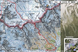
Trying to utilize the new features provided by Google Maps, I have established a new standard to display the ALP summit log, the alpine info source at My Places.
In the latest version, apart from the pics and placemarks, You can find the tracklog of the path we used, along with a short summary of our experiences and recommendations. In case of climbing routes, there is a topo instead of the tracklog. Furthermore, there is an alpinistic map overlay to serve even more info about the territory. Currently, all these new features are available for our ascent on Mont Blanc, but the rest is coming soon.
In case of cycling routes, You can also find useful pieces of info as well as the elevation diagram of the route.
I needn't mention that this stuff is still embedded into a standard kml file, so in the future editions of Google Maps for Mobile You will most likely be able to find and display this info on the screen of your cell phone. And we have a good chance to enjoy GPS support, too :)


No comments:
Post a Comment